
|
|
|
 |
|
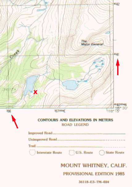
The red arrows point to the UTM marks on your USGS Topographic map. On 7 1/2 minute and 15 minute maps, the distance is 1,000 meters between ticks. The left arrow is the East-West axis: 3 86 000. On the upper right is the North-South axis: 40 41 000. The X is located at about E386500 and N4040200 (you needn't be more accurate than within 500 meters or so...). If you
have a GPS unit, you can change it from the usual Latitude/Longitude
coordinates to UTM using the setup menu. For an even more detailed explanation, check out the USGS Fact Sheet on how to read UTM's. |
Our Founder Questions? Go to About Our New Site |
Masthead
Photo from: |