|
|
|
Mapping
Sequoia & Kings Canyon’s Vegetation:
From Muhlenbergia filiformis to Sequoiadendron giganteum
By Laura Pilewski
vegetation-mapping crew field botanist, Sequoia National Park
 |
|
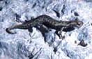
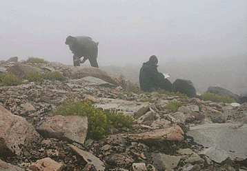
Researchers aquire a primal understanding of life
in the alpine zone: talus and goldenbush (Ericameria sp.), fog
and cold. |
Like most humans, we love superlatives: the biggest, the tallest, the deepest — and Sequoia and Kings Canyon National Park has them all. That is primarily why they were set aside as one of our first national parks. However, they probably would have never been created if it were only for preserving purple mountain parsley (Oreonana purpurascens), the Sequoia gooseberry (Ribes tularense) or the newly discovered (1983) monkey flower (Mimulus norrisii).
These species, along with all of the common ones, each play an important role in our ecosystem. In order to protect and mange them, park biologists need to know what is out there in the first place.
The
Vegetation Mapping Program
1999 was an exciting year because the National Fire Management Program in
Boise reached an agreement with the Inventory and Monitoring (I&M) program
to provide initial funding to describe and map the terrestrial vegetation
within these two parks. Obtaining the money was only the beginning. It was
then up to the park’s plant ecologists to figure out an efficient way
to map the 863,741 acres within only four years. Since there are already over
25 I&M parks participating in the vegetation mapping program, it was helpful
to look at local ones like Yosemite that had already tackled this project
successfully. Project Coordinator Sylvia Haultain met with numerous agencies
involved with this collaborative effort such as The Nature Conservancy, United
States Geological Survey-Biological Resources Division, the US Forest Service,
the California Department of Forestry, and various biologists from Point Reyes
and Yosemite. California state vegetation ecologist Todd Keeler-Wolf has been
especially helpful in guiding sampling protocols and local vegetation classification
schemes in conjunction with the air-photo interpretation process.
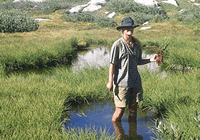 |
| Sequoia Park botanist Marcel Munnecke at play in the fields of the lord. |
Table 1:
|
The U.S. National Vegetation Classification System Hierarchy |
||
|
Level |
Primary Basis for Classification |
Example |
|
Class |
Growth form and structure of vegetation |
Woodland |
|
Subclass |
Growth form characteristics, e.g., leaf phenology |
Deciduous Woodland |
|
Group |
Leaf types, corresponding to climate |
Cold-deciduous Woodland |
|
Subgroup |
Relative human impact (natural/semi-natural, or cultural) |
Natural/Semi-natural |
|
Formation |
Additional physiognomic and environmental factors, including hydrology |
Temporarily Flooded Cold-deciduous Woodland |
|
Alliance |
Dominant/diagnostic species of uppermost or dominant stratum |
Populus deltoides Temporarily Flooded Woodland Alliance |
|
Association |
Additional dominant/diagnostic species from any strata |
Populus deltoides - (Salix amygdaloides) / Salix exigua Woodland |
From: Terrestrial Vegetation of the United States, The National Vegetation Classification System
Sampling multiple plots of the same association allows vegetation ecologists to extrapolate what species can be expected elsewhere in the park without actually visiting every square inch of it. Plots vary in size from 100 m2 to 1000 m2 according to the structure of the vegetation being sampled. For each plot, environmental variables such as substrate, topography, elevation and water regime are recorded. Cover classes for non-vegetated and vegetated strata are also documented to give an idea of how much of each species was present and what they were interspersed with (i.e. boulders, wood, litter & duff). Last, but not least, every vascular species was either keyed to the subspecies level on sight or pressed for later identification.
At the end of the season when field teams could climb no higher to find flowering vegetation, they called it quits and retreated to the dusty confines of the Ash Mountain Research center. There, they diligently keyed as many pressed specimens as possible and sent some out to experts to expedite this sometimes tedious and exacting process. With over 1400 vascular plant species found in Sequoia and Kings Canyon, this was quite a chore for those who remained through September.
 |
|
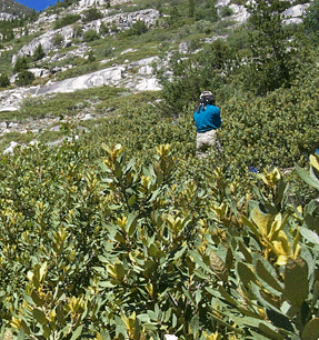
Botonist Li Miao plotting her next plot amongst the
Chinquapin (Chrysolepis sempervirons). |
Field
Season 2001
When spring 2001 rolled around, the new crew leader Jennifer Akin gathered
workers early to do sampling that was missed the previous year among the Sierran
foothills, a place often overlooked by visitors. The hills here are briefly
lit aflame with such flowers as the California poppy (Eschscholzia californica),
common madia (Madia elegans), and fiesta flower (Pholistoma auritum).
All of these are scattered beneath a canopy of old, sculpted oak woodlands.
Our teams were both blessed and cursed to bushwhack to places that are almost
never visited by hikers. This is in part due to the poison oak (Toxicodendron
diversilobum), western rattlesnakes, ticks, and extreme heat that constitute
this wilderness.But we were excited to be back in the park with newly generated
photographs (aerial color Infrared; 1:15,840) to guide us. Photo interpreters
(PI’s) from Aerial Information Systems (AIS) have put hours into squinting
over stereoscopes
to delineate polygons around vegetative associations. This not-so-new technology
still serves as an invaluable tool especially when one is trying to describe
vast landscapes and places, such as the foothills, where one does not have
many vantage points to view vegetative patterns.
The tentative plan for the remainder of the field season will be to capture as many plots as possible within associations that are not yet adequately described. The maps provided by AIS will help concentrate efforts in these places as well as ones that the PI’s have questions or difficulties with. Conversely, the ground teams will continue to describe associations and observations too small to be seen in the photographs.
Final Result
When the project is all said and done, the park expects to have a highly accurate
and detailed vegetation map that meets standards set by the Federal Geographic
Data Committee and National Vegetation Classification. This exciting new product
will be dynamic in nature primarily due to state-of -the-art GIS technology.
Using mapping GIS programs, researches will be able to create maps of the
Sierra showing the vegetation associations, wildlife sightings and other critical
data collected in the last century. These maps will have infinite applications
among the research community. The Fire Management program will especially
appreciate these long awaited maps for predictive fuel modeling. Other divisions
including the wildlife biologists will use these maps to delineate potential
habitat/forage areas for species. Even road and trail construction crews can
use them to avoid areas that may contain sensitive species. These maps will
provide a wealth of information to both the park and the public. Armed with
this knowledge, the NPS will be better able to truly protect and preserve
for future generations what we know and love in the Sierra Nevada.
For Further
Reading:
Sawyer, John O. and Todd Keeler-Wolf. 1995. A Manual of California
Vegetation. Sacramento:471pp.
Weedon, Norman F. 1999. A Sierra Nevada Flora. 4th
ed. Berkeley:259pp.
Web Links:
Sequoia-Kings
Canyon National Park I&M website
USGS
- NPS Vegetation Mapping Program
Terrestrial
Vegetation of the United States, the National Vegetation Classification System
Our Founder Questions? Go to About Our New Site |
Masthead
Photo from: |