|
|
|
2006 Report on Analysis of Lakes and Streams in Kings
Canyon National Park for Coliform Bacteria and other Microorganisms
Robert W. Derlet, M.D.
Professor
University of California, Davis
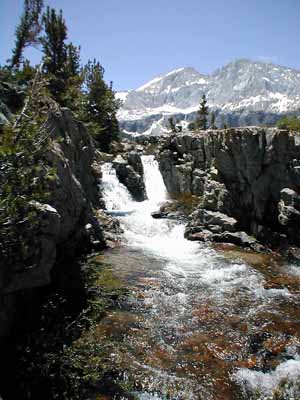 |
Bubbs Creek, Kings Canyon National Park |
The Sierra Nevada Mountains watershed provides 50% of California’s fresh water for domestic use. Melting snow must pass through a fragile ecosystem prior to runoff into lowland reservoirs. This ecosystem, primarily granite or metamorphic rock has little buffering capacity, and therefore small amounts of environmental pollution, may have a significant impact on biotic life. Over the past 40 years, deposition of rate limiting substances by humans, and domesticated animals and increases in air pollution from the central valley have resulted in increasing eutrophication, and increases in phytoplankton species and biomass. We hypothesize that this changing environment may also affect the presence of total and pathogenic bacteria. Therefore, identifying specific factors that are associated with harmful bacteria are important. Much of this watershed encompasses roadless, backcountry wilderness areas which have limited and restricted use. Understanding factors that impact the water quality from these areas is important for use restrictions and management decisions.
Coliform bacteria have been established as indicators of fecal pollution of watersheds. The findings of coliforms would indicate that the watershed carries a risk for water-borne diseases such as entero-invasive E. coli, Salmonella, Campylobacter, Yersenia species and other microbial pathogens, some of which can survive for extended periods in the environment. The objective of the current study was to determine coliform presence in Kings Canyon National Park backcountry, and study associated indicators of human impact on water including total bacteria, algae biomass, as well as indicators of chemical pollution.
METHODS
A total of 33 study sites in back country lakes and streams in Kings Canyon
National Park were analyzed during the summer of 2006. Analysis consisted
of observation comparisons of algae biomass, amount of non-organic stream
and lake foam, a quantitative assessment of heterotrophic bacteria, and
determination of the presence of coliforms. The following methods were
applied:
RESULTS
A total of 33 sites were analyzed as listed below, followed by the site Elevation
and Risk category. The risk category abbreviations are:
Algae: Very high algae biomass was noted at the following four sites:
Lower Rae Lake (5+)
Arrow Lake (5+),
Dollar-Arrow
Creek crossing (5+), and
Dollar Lakes (5+).
High algae biomass was observed
at:
Kings River in Lower Paradise (4+).
All other sites had between 0 - 3+ algae.
Soap/Chemical Foam: 5+ foam was noted at:
Darwin Bench draining Darwin Canyon single observation
Dollar Lake, and
Bubbs Creek just below Vidette Meadows.
Bacteria: Significant heterotrophic bacteria, greater
than 5,000 CFU/mL were found at:
Darwin Bench
Dollar Lake, and
Bubbs Creek at Vidette Meadow.
Coliforms: Overall, coliforms were
found in six of the 33 sites (18%). These sites include:
Lower Bubbs Cree
Lower Rae Lake
Dollar Lake
Woods Lake
Kings River at Lower Paradise, and
Darwin Bench drainage.
Analysis by risk category
showed coliforms as follows:
W (Wild areas) – 0 of 7 sites = 0%
DH (Day Hike areas) – 0 of 3 sites = 0%
BP (Backpack areas) – 1 of 9 sites = 11%
PA (Pack Animal areas) – 5 of 14 sites = 36%
DISCUSSION
Algae:
Algae have become a significant problem in certain parts of the park. In
particular algae biomass is greatest in the Rae Lakes area from Dollar Lake
upward to Lower Rae Lake. These areas are heavily used both by backpackers
and stock.
Foam:
Foam was also found in two areas heavily used by stock and backpackers, Dollar
Lake and Bubbs Creek at Vidette Meadow. A surprise finding of foam in the
Darwin Bench was unexpected. In addition to finding foam on the Darwin Bench,
both increased numbers of bacteria and coliforms were found. This suggested
that this area which is considered lightly used and does not have a designated
trail may have been impacted heavily by backpackers this summer.
Total Bacteria:
Total bacteria correlated well with Backpacker and Pack Animal use.
Coliforms:
Data by risk category is consistent with prior studies in SEKI, as well as
data from the entire Sierra which involves nearly 500 water samples which
we have made over the past five years. This year, five of the sites growing
coliforms were from areas heavily utilized by pack animals, consistent
with findings from the previous four years. Unexpected findings of
coliforms occurred in at 2 sites: Woods Lake, and Darwin Bench. The Woods
lake sample was taken along the shore near several campsites. These coliforms
from Woods Lake could have arisen either through natural causes (which
is found in approximately 10% of the Sierras) or pollution from nearby
campsites. The finding from the Darwin Bench likewise could have been natural
background or from backpackers in Darwin Canyon. The finding of soap foam
in increases the likelihood of human source. Backpacker traffic over Lammack
Col was observed by me to be heaver than initially anticipated.
FUTURE STUDIES
Future studies need to be directed in a number of areas. This would include
more quantitative analysis of algae using chlorophyll extraction and analysis
techniques. In addition, analysis of foam by subjecting foam and water
from foam sources to multi-variant chemical analysis would helpful to determine
the possible sources. Excessive foam results from soaps, detergents, cleaning
agents or sunscreens used by backpackers. Although coliforms in this study
were found in areas used by both backpackers and stock, other studies in
the Sierra for which stock can be excluded, suggest that most of the coliforms
are as a result of direct desposition of stock manure into waterways. A
specific study area watershed could be created within the park that would
help to further investigate algae, foam, bacteria and coliforms. Such a
study area would be selected and the results compared with a similar area
that did not have study area restrictions. For example, the hypothetical
Evolution Valley study area could be compared to another area in the park
over several years. Study area restrictions could include prohibiting use
of soaps or cleaning agents in the area, preventing grazing which would
minimalize stock use and prohibiting camp fires which should decrease camp
sites.
The high sierra are under ever increasing pressure from back packers, campers , and domestic animals used for transport or simply for grazing on public lands. The park service has the responsibility of doing its best to preserve the quality of the Sierra Nevada for this and future generations. Although this report is based largely on carefully recorded observations over past summer it also contains quantitative analysis of bacterial contamination at a number of sites, and organization and understanding from 5 years of field work on backcountry water in SEKI. If only these are considered they represent clear evidence that there should be current and future concern for water quality derived from the higher elevations. Plans should now be developed to prevent future deterioration. This is now particularly urgent since with the anticipated climate change we are expecting more rainfall and less snow at the higher elevations so that preserving the integrity of the forests, the ground cover and the standing and flowing waters. becomes increasingly important. The NPS has both the opportunity and the responsibility to respond to the research and management needs that these changes require.
RECOMMENDATIONS:
Our Founder Questions? Go to About Our New Site |
Masthead
Photo from: |